


|
|
C&O Milepost 91.3
Station Number: 91
Code Number: 0136
The town takes its name from Andrew R. Ellerson who owned a mill on the Beaverdam Creek. On June 26, 1862, the seven day’s battles were begun here and at nearby Mechanicsville, though Ellerson, a Confederate soldier, was assigned elsewhere at the time. He returned home after Appomattox.
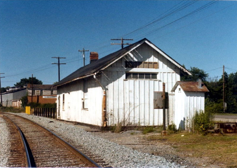
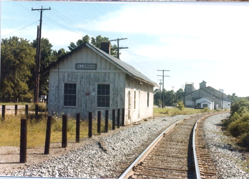
Ellerson had a station and agent listed in 1948. During the mid-1970’s passengers from Richmond were bused to the Ellerson depot to catch trains going from Newport News to Charlottesville. According to a 1994 article by Tom Dixon (see references) the station at Ellerson was a modified version of a combination depot used on both the C&O and the Pennsylvania. Dixon describes the depot as having weatherboard sides, board-and-batten wainscoting, and decorative vertical boards above the window line. A 1949 photo of the Ellerson depot, however, was of a much plainer station with board-and-batten siding and none of the trim that decorated the Pennsy design station (see below). Most likely the earlier station burned, but whether that’s true or not and when it occurred is just one more little mystery to solve...
According to the 1937 Side Track Record, Ellerson had a house track (track number 820) 1617' in length that ran behind the station. It served the A&UI Manufacturing Company, Fred S. Bock (I don’t know what this business did), and Bradley & Boswell (a fertilizer dealer). The C&O’s 1950 Industrial Directory listed Ellerson as having a team track with a capacity of 12 cars that served the following industries: the Alliance Fertilizer Co. and Bradley & Boswell. The run-around track (track 2659) was added in March, 1954 and the siding was extended in April, 1964. Another track (number 2900) was added in April, 1963, but I’m not sure where it was located. This track was revised in 1977. Portions of tracks 820 and 2659 were retired in April, 1991. Both are gone now.
Photos |
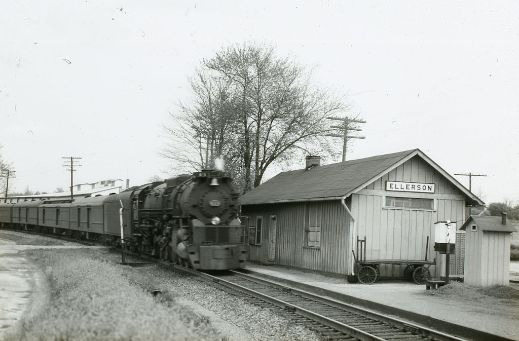
A C&O passenger train, led by 4-8-4 #613, passes the Ellerson depot. The slide has what looks like a date of 4-5-51 written on it, but Bill Sparkmon pointed out that that date cannot be correct: at that time the 613 had smoke lifters. (Photographer unknown. From a slide in the collection of Larry Z. Daily.)
The Ellerson depot in November of 1970. The photographer must have been aboard the George Washington. (Photographer unknown. From a slide in the collection of Larry Z. Daily.)
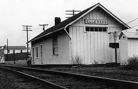
This is the C&O depot in Ellerson in January of 1971. The photographer was facing west. At one point, Amtrak was busing Richmond passengers to this building to board trains. It was demolished in 1985. (Photo by Thomas W. Dixon, Jr. Used with permission.)
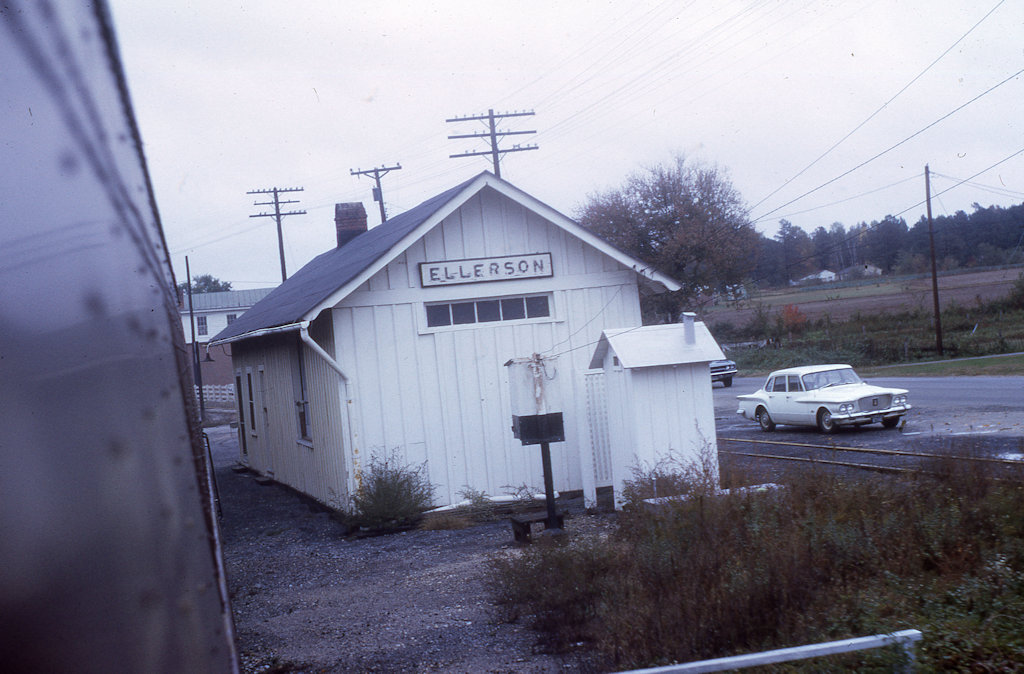
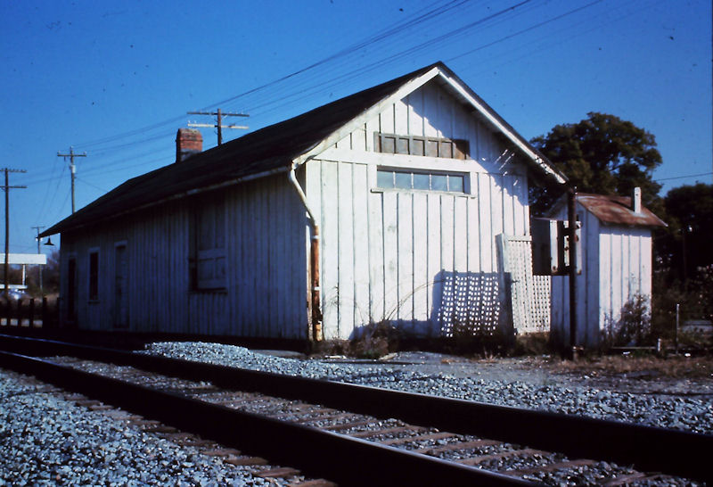
This photo of the depot in Ellerson was taken on January 17 of 1971, about the same time as the one by Tom Dixon above. (Photographer unknown. From a slide in the collection of Larry Z. Daily.)
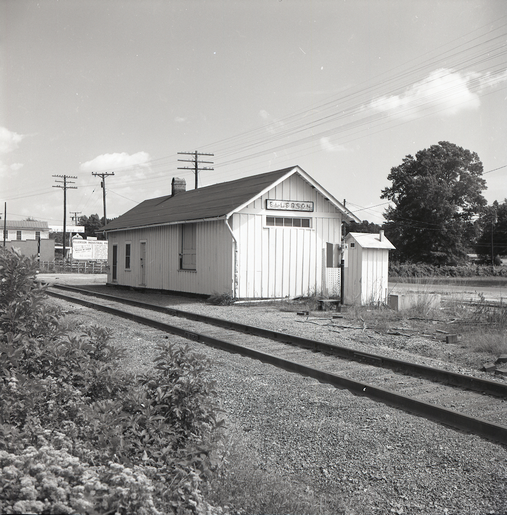
[NEW] The next three photos were all taken on September 15, 1974. This one shows Ellerson depot from the south. You can make out a sign for the Ellerson Industrial Park in the background. (Photographer unknown. From a negative in the collection of Larry Z. Daily.)
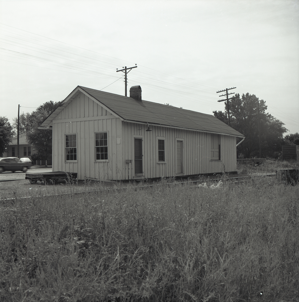
[NEW] This photo and the next one are the only ones I have of the “streetside” of the depot. There’s a boxcar visible in the background, but as I understand the track arrangements in Ellerson, it would have to be out on the main. (Photographer unknown. From a negative in the collection of Larry Z. Daily.)
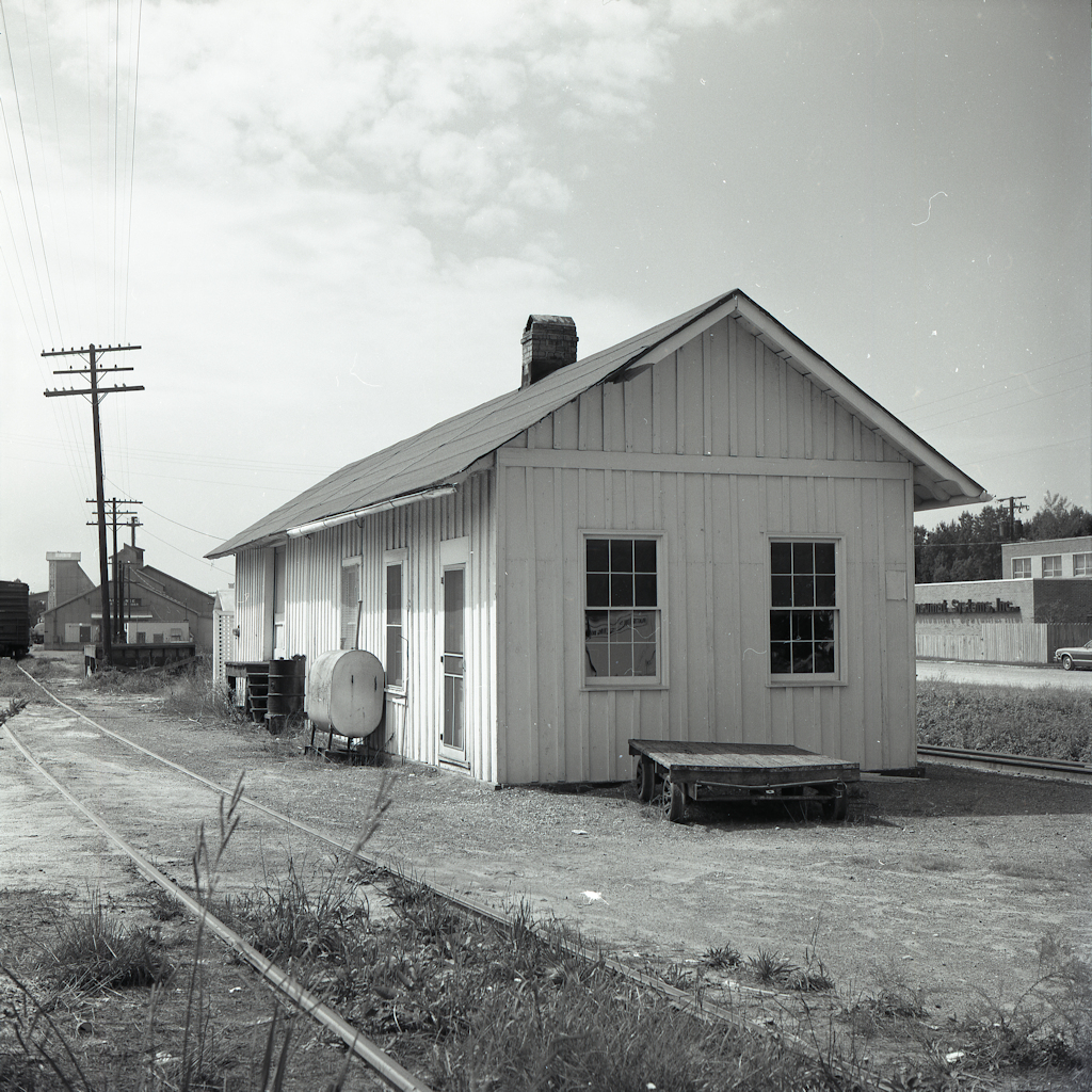
[NEW] Another “streetside” view of the depot. Alliance Fertilizer is visible in the background. There’s also a boxcar there, but I can’t make out the reporting marks. (Photographer unknown. From a negative in the collection of Larry Z. Daily.)
This photo of the station was taken in June, 1983. Gleb Taran, the photographer, was facing north. In the background you can see the Bradley and Boswell fertilizer warehouse. The end of the warehouse facing us housed a 1930’s (or 1940’s) era Amoco station with a general store. The store was known as the Bradley and Boswell store and closed in the early 1970’s. (Photo by Gleb Taran. Used with permission.)
Taken at the same time as the previous photo, this one shows the view to the south. The large building in the background is the Alliance Fertilizer Company. The small white building between the station and the warehouse had once been the Ellerson post office, but in 1983 served as offices for the fertilizer company. (Photo by Gleb Taran. Used with permission.)
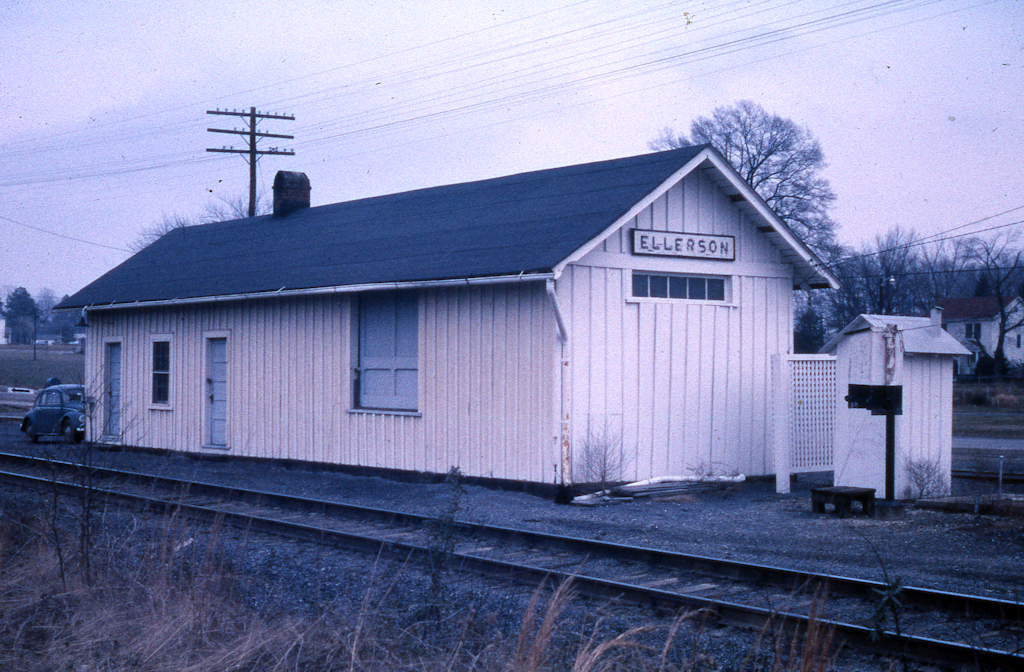
I’m guessing that this photo was taken at about the same time as the previous two photos. (From a slide in the collection of Larry Z. Daily.)
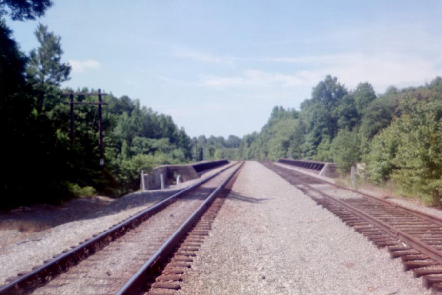
Looking towards Richmond over the C&O bridge across I-295, from the grade crossing at Holly Grove Road, between Ellerson and Atlee. (2002 photo by Stephen Willard. Submitted by Charles Willard. Used with permission.)
Maps |
 |
This map was prepared from U.S.G.S. topological maps, C&O track charts dated 1963, C&O Side Track Records dated 1937, a copy of the Side Track Records updated through the 1990’s, and C&O Valuation maps, also updated through the 1990’s. |
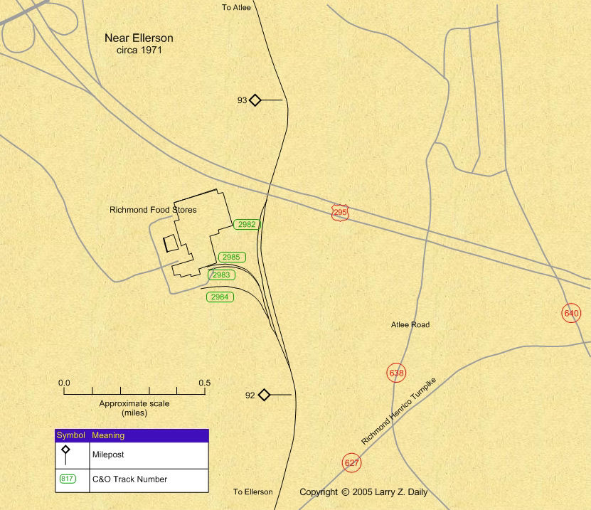 |
In 1971 the C&O built several spurs to serve the Richmond Food Stores facility. Track number 2984 was retired in 1987. This map was prepared from U.S.G.S. maps, C&O track charts dated 1963, and the 1937 C&O Side Track Record. |
Stations |
|
You are visitor number
to this site since the new counter was inaugurated on June 28, 2004.
This site was originally established in 1997.
| Mail comments to: | Larry Z. Daily |
Please note that, due to a huge volume of spam coming in on my email account, I’ve had to change my email address. The new address is lzdaily@nospam.piedmontsub.com (but remove the nospam and the dot before piedmontsub.com).
Copyright © 1997-2025 Larry Z. Daily. All rights reserved.
All materials on this Web site are protected by United States
copyright law. This includes, but is not limited to, articles and graphics. Unless
otherwise indicated, these materials are the property of Larry Z. Daily and may not
be used without prior written permission of Larry Z. Daily