

|
|
C&O Milepost 90.1
Station Number: 90
Code Number: 0134
The Chickahominy stop, previously known as Hunslett (McChord, 1978), was named for the river that the C&O crossed with three separate bridges just north of here. The river’s name possibly came from the Native American word checahaminend, which means “land of much grain” or possibly from a local tribe whose name meant “coarse pounded grain people” (Hanson, 1969). As I understand it, Chickahominy was primarily a commuter stop and remained a flag stop on public timetables into the early 1960’s.
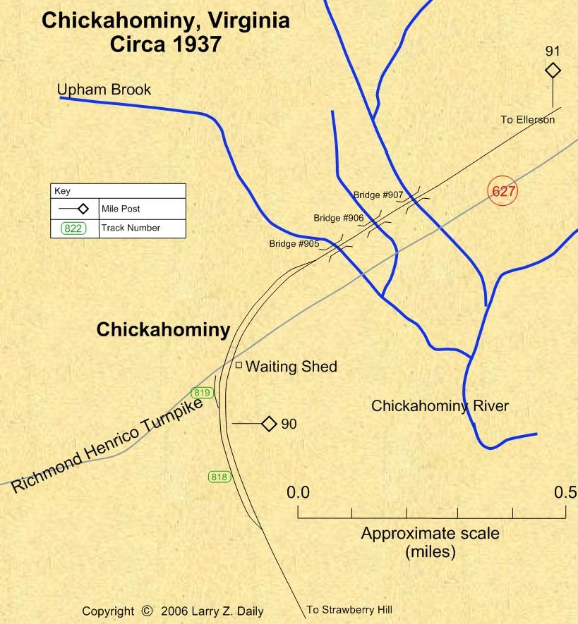
According to the 1937 Side Track Record, the C&O had a 3369' passing track (track number 818) in Chickahominy. There was also a 225' team track (track number 819). Gleb Taran writes, “...the 225' team track (track 819) no doubt serviced the dairy farm operation that was located in the wedge formed between Richmond-Henrico Turnpike (Meadowbridge Road) and the C&O. The west side of the dairy barn was about 30 feet from Meadowbridge Road and paralleled the road. The north side of the barn abutted what would have been the team track (track 819). The ruins of the dairy barn were still visible as late as 1980. The stock pens around the dairy barn were still visible in the 1960s. This entire farm site has been converted to parking for the Richmond International Raceway (RIR) at Strawberry Hill within the last 20 years.” Tracks 818 and 819 were retired in December, 1942. The company petitioned the Virginia State Corporation Commission for authority to discontinue Chickahominy as a freight station in late 1956. At the time, C&O facilities in Chickahominy consisted of a small shelter shed. It was retired in 1962.
Photos |
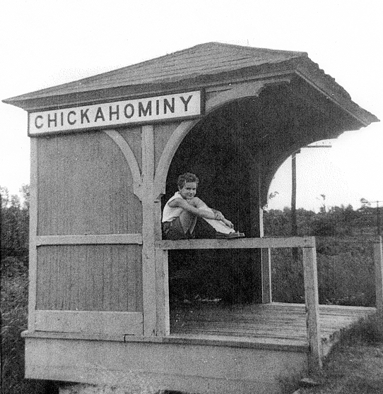
This passenger shelter stood in Chickahominy. Locals stopped here to take passengers into Richmond. Once common across the C&O, this little shelter was an anachronism even in 1948. The photo was taken around 1958. The shelter and platform were retired by the C&O in May of 1962. (Photo by Mrs. Vera Pate. From the collection of Thomas W. Dixon, Jr. Used with permission.)
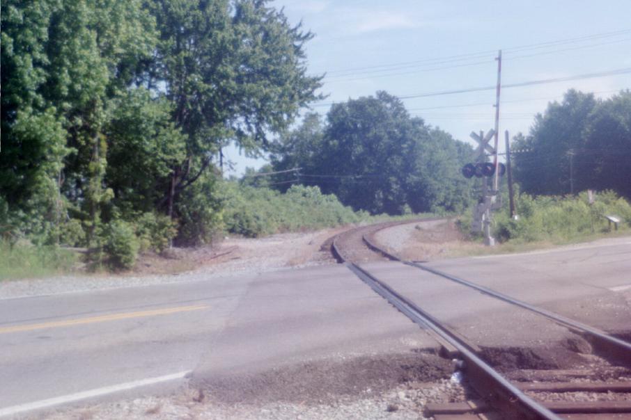
The passenger shelter stood beyond the right front edge in this photo. In the 1940’s the road wasn’t quite so nice or so busy as it is today. (2002 photo by Stephen Willard. Submitted by Charles Willard. Used with permission.)
Maps |
These maps were prepared from U.S.G.S. topological maps, C&O track charts dated 1963, C&O Side Track Records dated 1937, a copy of the Side Track Records updated through the 1990’s, and C&O Valuation maps, also updated through the 1990’s.

Stations |
|
You are visitor number
to this site since the new counter was inaugurated on June 28, 2004.
This site was originally established in 1997.
| Mail comments to: | Larry Z. Daily |
Please note that, due to a huge volume of spam coming in on my email account, I’ve had to change my email address. The new address is lzdaily@nospam.piedmontsub.com (but remove the nospam and the dot before piedmontsub.com).
Copyright © 1997-2025 Larry Z. Daily. All rights reserved.
All materials on this Web site are protected by United States
copyright law. This includes, but is not limited to, articles and graphics. Unless
otherwise indicated, these materials are the property of Larry Z. Daily and may not
be used without prior written permission of Larry Z. Daily