


|
|
C&O Milepost 165.2
Station Number: 165
Code Number: 0250
Telegraph Callsign: DA
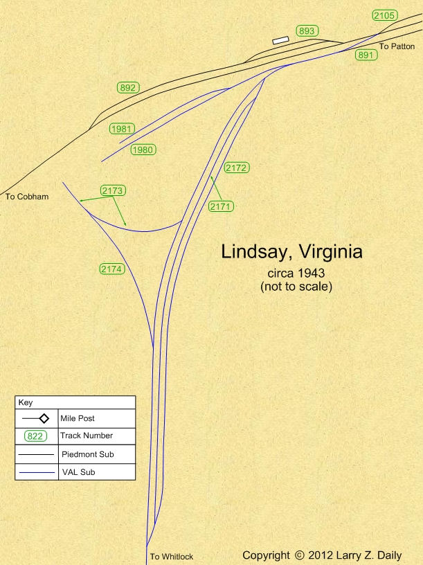
Lindsay, 5 miles west of Gordonsville, was one of the earliest stations on the Piedmont Sub. It was listed in the 1854 Annual Report of the Virginia Central. It was apparently one of those sidings originally built at the request of a wealthy family; one reference I found called it Lindsay’s Turnout and noted that it was an election precinct. Lindsay was also the site of the junction of the Piedmont and the Virginia Air Line Subs. According to the 1937 Side Track Record, Lindsay had a 2360' storage track (track 891), a 3354' passing track (track 892), and a 573' house track (track 893). The track configuration was very similar to that shown on the map below. The east turnout of the house track was removed by December of 1941. Track 2105 appears to have been built before December 1942. In July of 1949, the C&O discontinued the agency and telegraph office at Lindsay. In 1956, the railroad stopped handling LCL freight here and limited freight handling to carload freight only. Track 891, the storage track, was retired in November of 1993. Track 2105 was retired in February of 2000.
Photos |
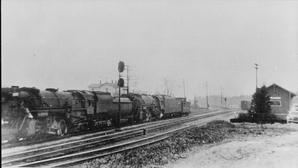
Lindsay once had a depot and several other C&O maintenance buildings. I couldn’t find any evidence of them when I was there, nor could I tell exactly where the VAL had branched off (but see the map below). This photo, taken I believe by Benjamin K. Biggers, shows both. (date unknown, Benjamin K. Biggers photo, provided by John Biggers, used with permission)
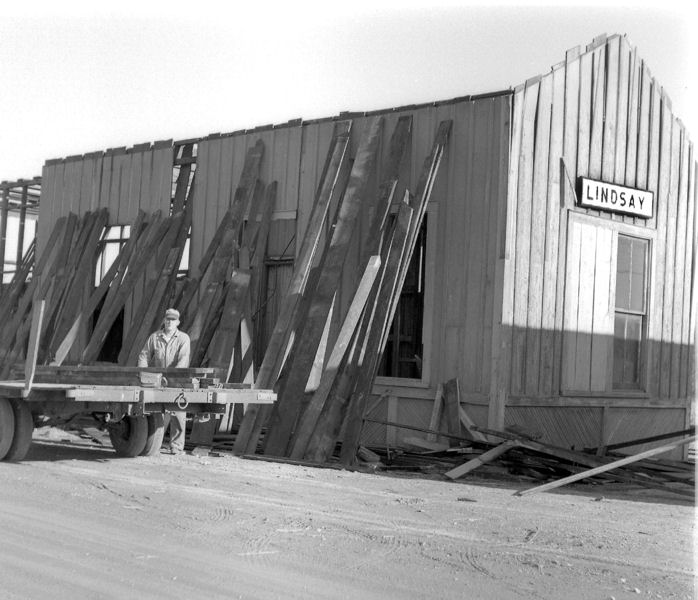
This photograph and the next one are some of the saddest on the site. They show the demolition of the Lindsay depot. The depot came down in the 1970’s. In this photo, Pike Harrington, a C&O engineer who also owned a farm in Lindsay, is dismantling the depot and recycling the lumber. (Photo by Eugene W. Harrington, Jr., provided by Lindsay M. Harrington, used with permission)
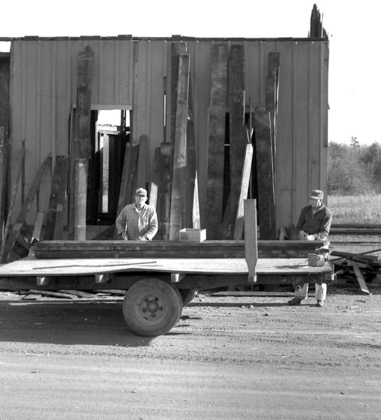
This photo shows Pike and his brother Williard. (Photo by Eugene W. Harrington, Jr., provided by Lindsay M. Harrington, used with permission)
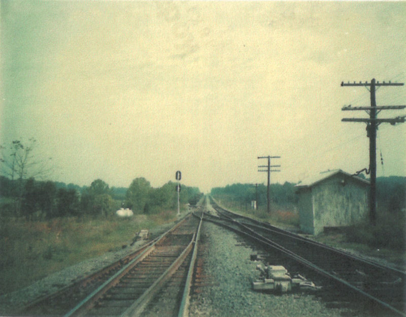
The Lindsay siding looking east. Harrington’s store was to the left of the photographer. (circa 1970, Benjamin K. Biggers photo, provided by John Biggers, used with permission)
Lindsay looking west. Note the maintainance sheds to the right. (circa 1970, Benjamin K. Biggers photo, provided by John Biggers, used with permission)
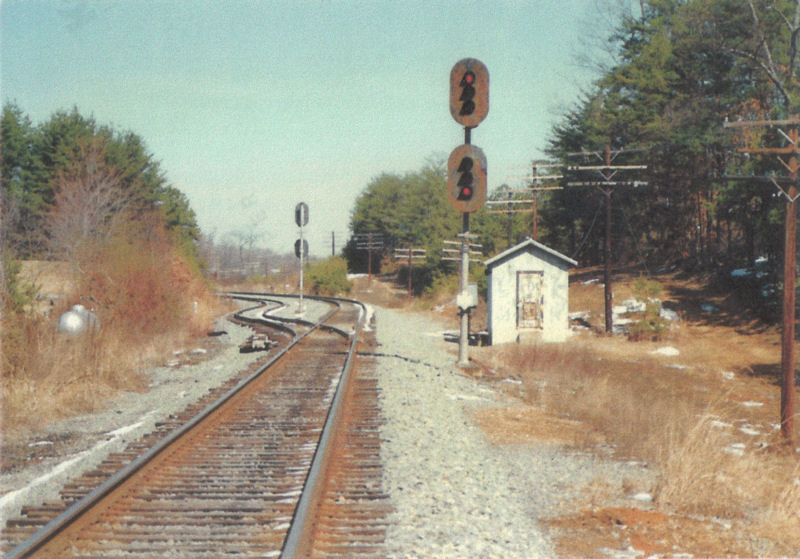
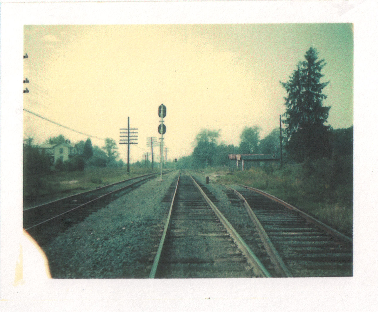
This is the west end of the Lindsay siding. (circa 1970, Benjamin K. Biggers photo, provided by John Biggers, used with permission)
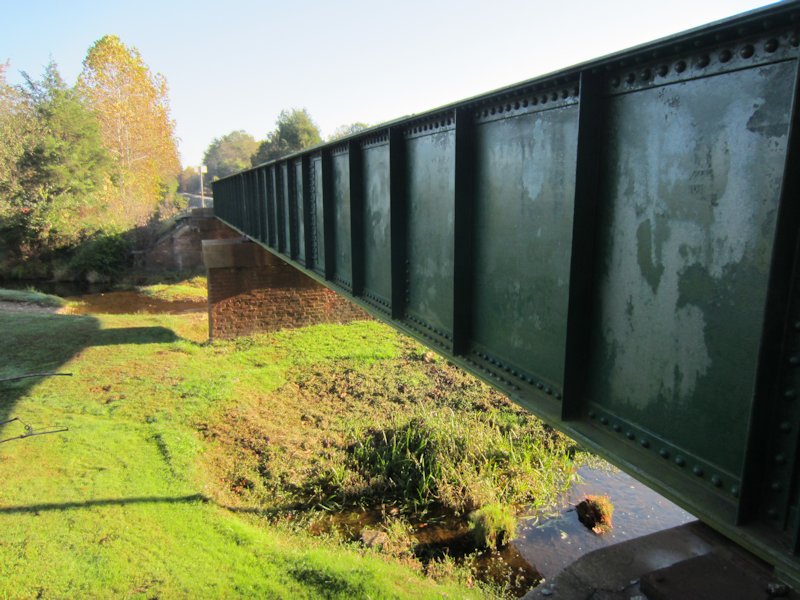
This bridge — number 1666 &mdasah; over Mechunk Creek was built in 1897. The owner of the land on either side has painted the outside of the girders a deep forest green. (2013 photo)
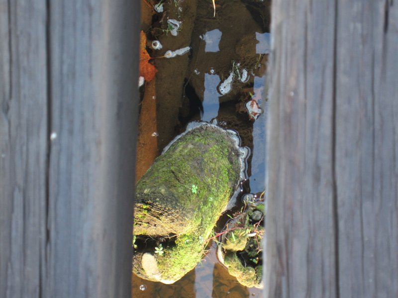
Visible below the existing bridge are wooden pilings from a far older — possibly the original — bridge. I most likely would never have noticed these if they hadn’t been pointed out to me by Gary Smith, a Buckingham Branch employee. Also, please know that I would never have ventured out on a railroad bridge if I hadn’t been with a railroad employee. (2013 photo)
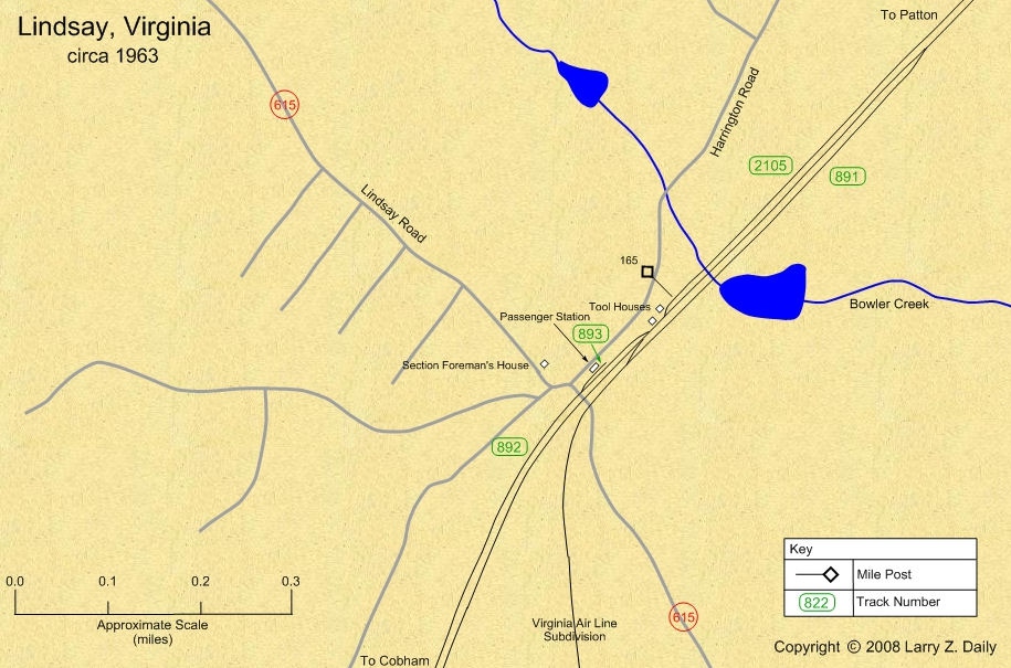
Maps |
The 1943 map was prepared from a copy of a Side Track Record provided by Wendell McChord. The 1963 map was prepared from U.S.G.S. topological maps, C&O track charts dated 1963, C&O Side Track Records dated 1937, a copy of the Side Track Records updated through the 1990’s, and C&O Valuation maps, also updated through the 1990’s.
Stations |
|
You are visitor number
to this site since the new counter was inaugurated on June 28, 2004.
This site was originally established in 1997.
| Mail comments to: | Larry Z. Daily |
Please note that, due to a huge volume of spam coming in on my email account, I’ve had to change my email address. The new address is lzdaily@nospam.piedmontsub.com (but remove the nospam and the dot before piedmontsub.com).
Copyright © 1997-2025 Larry Z. Daily. All rights reserved.
All materials on this Web site are protected by United States
copyright law. This includes, but is not limited to, articles and graphics. Unless
otherwise indicated, these materials are the property of Larry Z. Daily and may not
be used without prior written permission of Larry Z. Daily