


|
|
C&O Milepost 170.3
Station Number: 170
Code Number: 0288
Telegraph Callsign: CS
I’m not sure when the first station was built at Campbell, but it must have been early. The Virginia Central’s 1854 annual report listed “Campbell’s” as a station. McChord (1979) reported that the second depot was built in 1903. That depot was probably built to the 1892 standard and is, therefore, most likely the one shown in the photo below. Campbell had an agency station and telegraph office, but the telegraph office was closed in 1931 and the agency in 1932. The depot, coal house, and stock pen were all retired in December of 1933. At the same time, the shelter shed from Garnett was moved to Campbell. The 1937 Side Track Record showed a 2763' passing track (track number 896) and a 378' commercial loading track (track 897) as well as the shelter shed. In August of 1947 a watchman’s shanty was built at each end of the passing track. In December of 1956, the C&O discontinued handling LCL freight at Campbell and limited shipments to carload freight only. As of 1963, Campbell still had the passing siding and the passenger shed, but the loading track had been retired in place. The August 1973 C&O Historical Newsletter reported that the loading track had been spiked and was out of service. The passing siding was retired in April of 1978 and both sidings were removed then.
Photos |
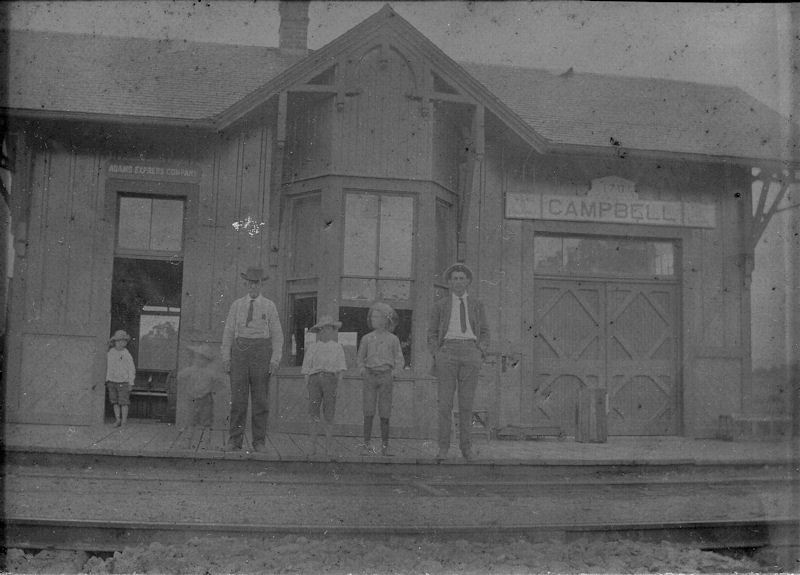
I acquired this photo of the Campbell depot in an eBay auction in the summer of 2011. The original had faded and acquired something of a yellowish tone, so I tinkered with it a bit using Paintshop Pro. This is the only photo I’ve ever seen of the Campbell depot and it’s only the second example — the other is Louisa’s depot — of the C&O’s 1892 standard station that I know of on the Piedmont Sub. (Date and photographer unknown. In the collection of Larry Z. Daily).
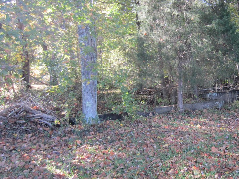
The Valuation maps show a freight warehouse across the tracks and the road from the depot location. This foundation is just about in the right place to be the foundation for that warehouse. (2013 photo by Larry Z. Daily).
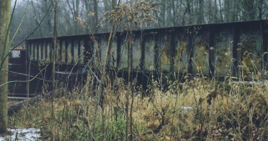
This is bridge number 1708. It crosses Mechunk Creek just south (west by timetable) of Campbell station site. (December 28, 1998 photo by Larry Z. Daily)
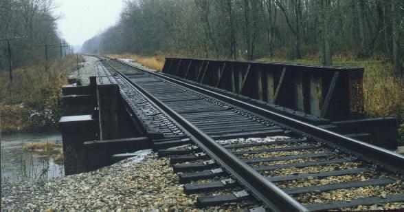
Bridge 1708 is similar in design to the other bridges I’ve seen along the Piedmont Sub. It’s a single track through plate girder bridge of two spans (for a total length of 88') and was built in 1897. (December 28, 1998 photo by Larry Z. Daily)
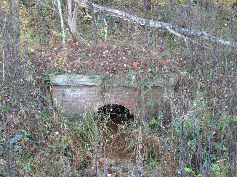
The U.S.G.S. maps show an abandoned grade just north (timetable east) of Campbell. The Valuation maps suggest that the change was made in 1946. This photo shows an old brick culvert on the old alignment. (October 18, 2013 photo by Larry Z. Daily)

Gary Smith shared a photo of another culvert on the old alignment. (2005 photo by Gary Smith. Used with permission).
Map |
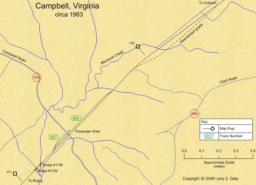
This map was prepared from U.S.G.S. topological maps, C&O track charts dated 1963, C&O Side Track Records dated 1937, a copy of the Side Track Records updated through the 1990’s, and C&O Valuation maps, also updated through the 1990’s.
Stations |
|
You are visitor number
to this site since the new counter was inaugurated on June 28, 2004.
This site was originally established in 1997.
| Mail comments to: | Larry Z. Daily |
Please note that, due to a huge volume of spam coming in on my email account, I’ve had to change my email address. The new address is lzdaily@nospam.piedmontsub.com (but remove the nospam and the dot before piedmontsub.com).
Copyright © 1997-2025 Larry Z. Daily. All rights reserved.
All materials on this Web site are protected by United States
copyright law. This includes, but is not limited to, articles and graphics. Unless
otherwise indicated, these materials are the property of Larry Z. Daily and may not
be used without prior written permission of Larry Z. Daily