


|
|
C&O Milepost 176.3
Station Number: 176
Code Number: 0295
Telegraph Callsign: SX
Shadwell is just east of Charlottesville and was the site of Peter Jefferson’s home in the 1700’s. Jefferson named his home after the English parish where his wife, Jane Randolf, had been christened. The Jeffersons raised six children at Shadwell, among them their son Thomas. The house burned to the ground in 1770. Between Shadwell and Belmont was the estate of the Randolf family. Their house, built in 1828 was called Edgehill. Later, the house was the site of the Edgehill School and the C&O’s station here was (according to one source I have) once called Edgehill.
Shadwell in 1835 was a fairly large town. It contained a large carding factory that employed 100 people, a large merchant mill owned by John Timberlake and Son, and a sawmill. Within the town were also several general stores, assorted shops and private dwellings. The Rivanna River was navigable as far as the town and grain, tobacco, and other agricultural products were shipped from Shadwell. Until 1850 the town prospered. The beginning of the end came when the carding factory burned and was not rebuilt.
The C&O reached Shadwell in 1849*. Shadwell was one of the earliest towns to have a station and agent: in 1850 it was one of only 10 depots on the line. As late as the 1860’s there were mills along the Rivanna River near Shadwell and, during the Civil War, the Virginia Central set up temporary shops there.
On November 4, 1897 the Fast Flying Virginian wrecked near Shadwell. The engine left the tracks taking the entire train, with the exception of one Pullman car and the diner, with it. Two of the derailed cars ended up in the Rivanna River. Three passengers and a coach porter were killed (Dixon, 1970, but another of my sources says that 5 were killed). Sixteen people were seriously injured. According to Dixon (1970) the accident was caused by spreading rails, but another source claimed that an investigation by the railroad commission concluded that the train was going too fast in an attempt to make up lost time.
The 1937 Side Track Record showed a 1363' passing siding (track number 900) and a 334' house track (track number 901) in Shadwell. The Industrial Directory of 1950 listed a team track with a capacity of 4 cars. The team track served the Grymes Oil Corp, a bulk gas and oil dealer. Shadwell accounts were handled by the agent in Keswick. In 1945 the turnouts between the passing siding and the main were removed, essentially combining tracks 900 and 901. The 1963 track charts show this configuration. A 1973 piece in the C&O Historical Newsletter reported that the switch to the “station spur” had been spiked and the spur removed from service. In March of 1974 the C&O built a 329' siding (track number 3010) to serve the Robert Lee Co. That siding was retired in 1992. During a December 1998 visit, I discovered that the foundation of the Shadwell station and platform still existed, though the foundation was half covered over by the parking lot of a fuel distributor. The siding was also still there though a pair of ties used as a wheel stop limited use to about half its original length.
Interesting trivia: In 1914, the C&O took delivery of a heavyweight 12-section, 1 drawing room sleeper named Shadwell. Another car in the same series was called Hewlett.
* - I’m no longer sure that the Shadwell named in my earlier sources is the place most commonly known by that name. According to McChord (1979), Massie was originally known as Shadwell and Shadwell was known as Edgehill. The Edgehill station was torn down in 1892 and a new depot was built. Edgehill was renamed Shadwell in 1894 and, at the same time, Shadwell was renamed Massie. The new Shadwell depot burned in December of 1914 and was replaced by the building pictured below. Massie had a shelter shed that was, most likely, removed around 1944.
Photos |
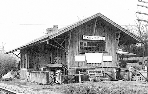
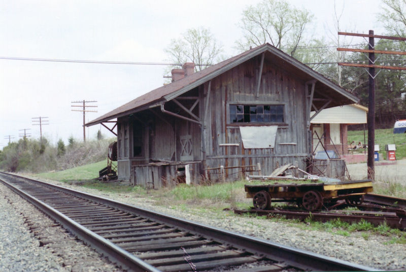
This is the Shadwell depot in April of 1972. At the time, it was being used as a storage shed by a gas station. (Photo by Thomas W. Dixon, Jr. Used with permission.)
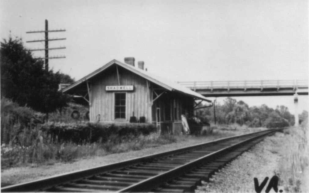
This view of the Shadwell depot is from a postcard. Because some of the junk piled around the station looks the same, I believe that this image is roughly comtemporaneous with the photo above, but I’m not really sure. (From a postcard in the collection of Larry Z. Daily)

[NEW] Here’s the streetside of the Shadwell depot. As noted above, it was used for storage by the gas station. (Photographer unknown. From a negative in the collection of Larry Z. Daily)
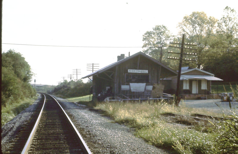
This is the Shadwell depot in October 1976. Until January of 2012, this was the only color image I had ever seen of this building. (From a slide in the collection of Larry Z. Daily.)
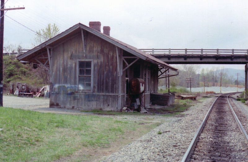
Shortly after I acquired the image above and noted that I had never seen a color photo of the Shadwell depot I received this photo from Ron Huffman. Ron took these photos in April of 1982. (Photos by Ron Huffman. Used with permission.)
Another photo of the Shadwell depot by Ron Huffman. (Photos by Ron Huffman. Used with permission.)
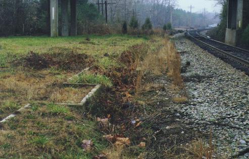
This is the foundation of the Shadwell depot. The back half is covered by the edge of a parking lot. The station platform used to extend to the other side of the bridge in the background. The bridge carries Rt. 250 over the line. (December 28, 1998 photo by Larry Z. Daily)
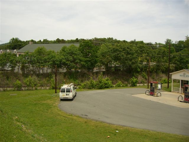
Here’s the Shadwell depot area as it appeared in the early 2000’s. (Photo June, 2008 by Lindsay M. Harrington. Used with permission.)
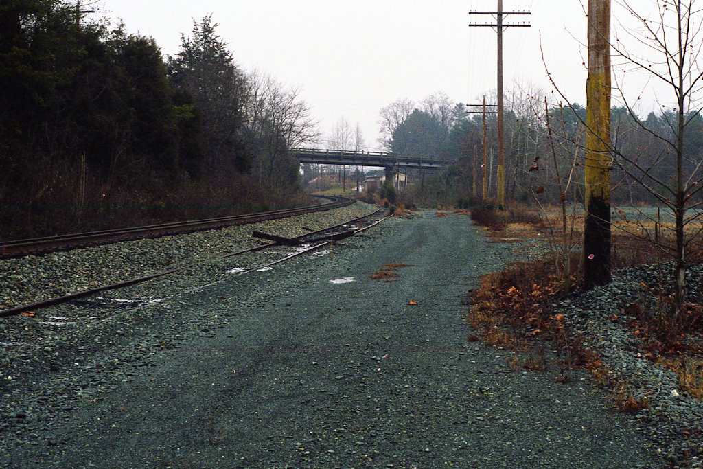
[NEW] This is the east end of the siding in Shadwell (track number 900). The depot stood on the other side of the bridge. (December 28, 1998 photo by Larry Z. Daily)
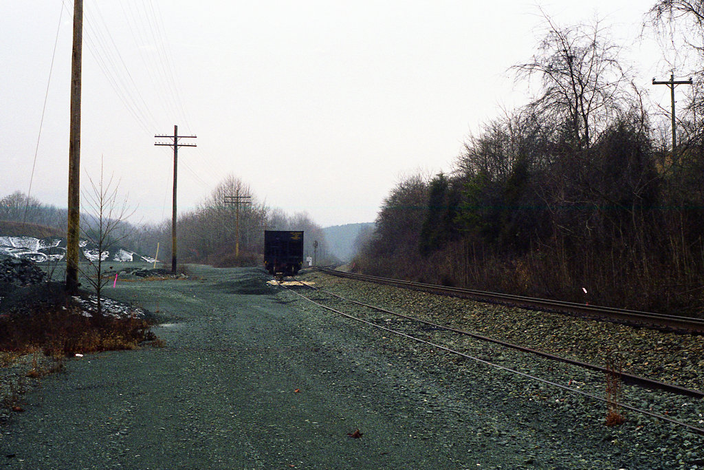
[NEW] This is the west end of the siding in Shadwell (track number 900). (December 28, 1998 photo by Larry Z. Daily)
Luck Stone has a large quarry near Shadwell. Looking at aerial photos, their siding is, I believe, what’s left of the old track 900. According to Gary Smith, Luck Stone does make some shipments via rail and also provides ballast to the Buckingham Branch Railroad. (October 17, 2013 photo by Larry Z. Daily)
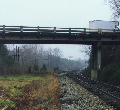
This is the Rt. 250 bridge over the Shadwell station location. Just off the left end Shadwell Station Rd. intersects 250 and twists down and around to the station site. The foundation is visible in the lower left corner of the picture. (December 28, 1998 photo by Larry Z. Daily)
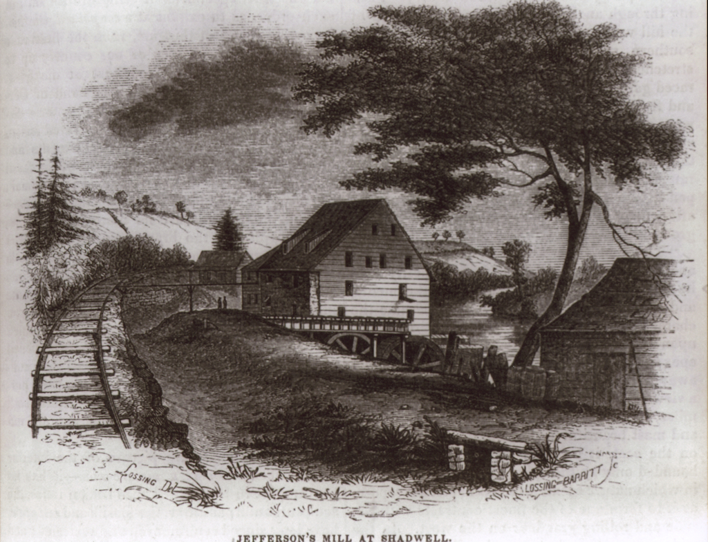
Peter Jefferson built a flour mill at Shadwell on the Rivanna River. That mill was destroyed in a flood in May of 1771. Thomas Jefferson built a toll mill in 1803 and a manufacturing mill in 1807. It is the latter that is shown in this image, which must have been created sometime after 1849 when the railroad reached Shadwell. For more information on the mill, see Jefferson’s Mills at the Monticello Web site.
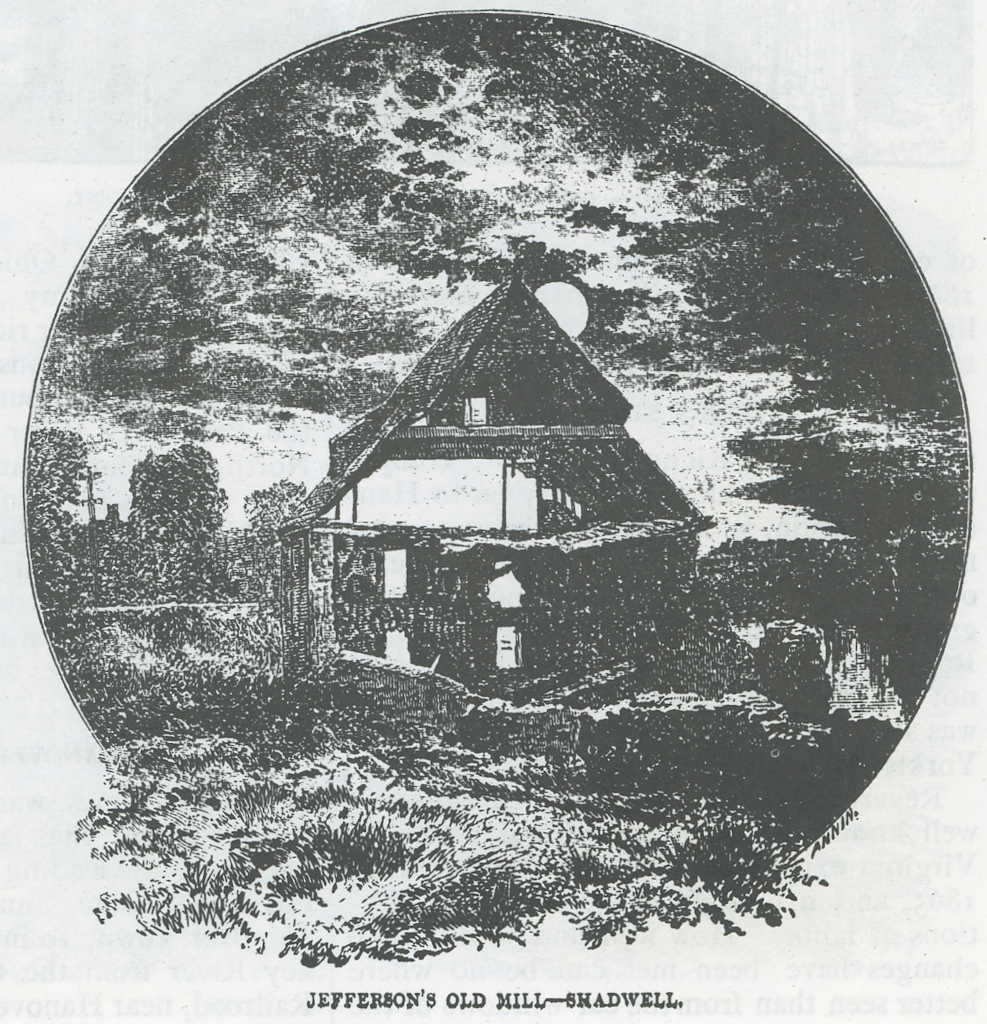
This image of Jefferson’s mill is from a publication titled Route and Resorts of the Chesapeake & Ohio Railway from 1878. Authorship of that small booklet was credited to Conway R. Howard, the C&O’s General Passenger and Ticket Agent, and J. C. Dame, Southern agent. The first half consisted of a general description of the C&O’s line and the second half was advertisements for resorts along the C&O.
Maps |
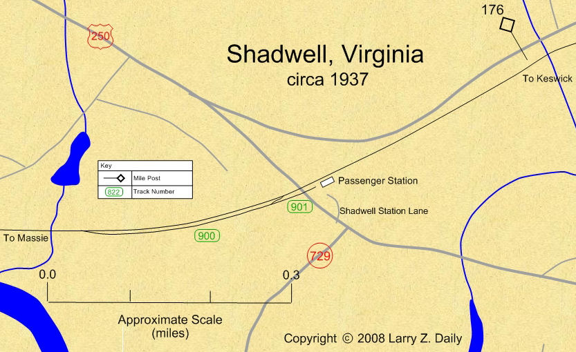 |
This map was prepared from U.S.G.S. topological maps, C&O track charts dated 1963, C&O Side Track Records dated 1937, a copy of the Side Track Records updated through the 1990’s, and C&O Valuation maps, also updated through the 1990’s. |
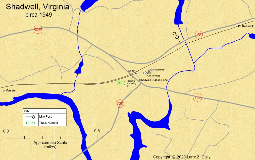 |
Some of the details on this map were obtained from C&O Drawing #D.E. 2446 dated June of 1949. |
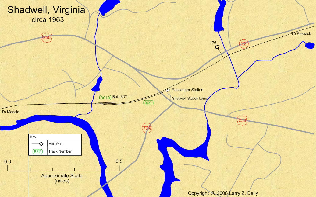 |
This map was prepared from U.S.G.S. topological maps, C&O track charts dated 1963, C&O Side Track Records dated 1937, a copy of the Side Track Records updated through the 1990’s, and C&O Valuation maps, also updated through the 1990’s. |
Stations |
|
You are visitor number
to this site since the new counter was inaugurated on June 28, 2004.
This site was originally established in 1997.
| Mail comments to: | Larry Z. Daily |
Please note that, due to a huge volume of spam coming in on my email account, I’ve had to change my email address. The new address is lzdaily@nospam.piedmontsub.com (but remove the nospam and the dot before piedmontsub.com).
Copyright © 1997-2025 Larry Z. Daily. All rights reserved.
All materials on this Web site are protected by United States
copyright law. This includes, but is not limited to, articles and graphics. Unless
otherwise indicated, these materials are the property of Larry Z. Daily and may not
be used without prior written permission of Larry Z. Daily